Kedarnath Temple Uttarakhand
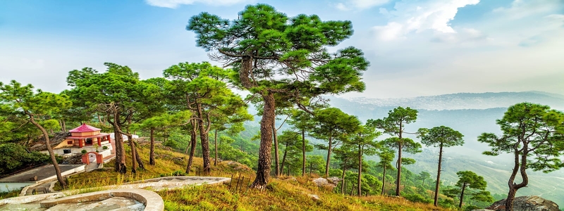
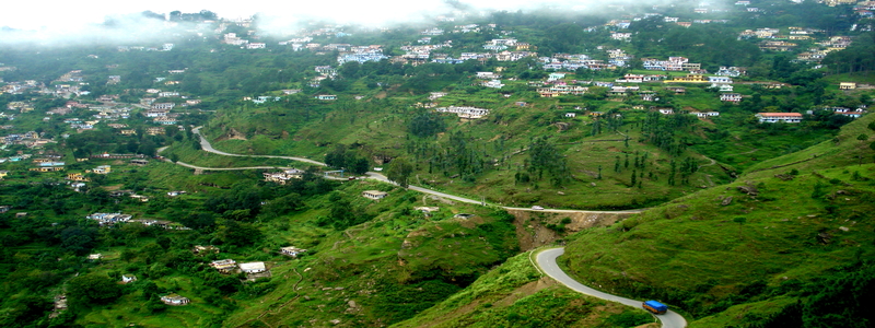
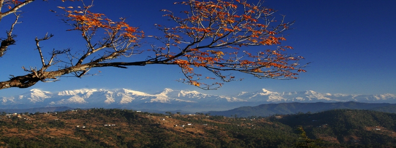
Kedarnath Travel Guide
About Kedarnath Tourism
Kedarnath Yatra is a Hindu holy town located in the Indian state of Uttarakhand. It is a nagar panchayat in Rudraprayag district. The most remote of the four Char Dham sites, Kedarnath is located in the Himalayas, about 3584m above sea level near the head of river Mandakini, and is flanked by breath taking snow-capped peaks. Kedarnath Temple hosts one of the holiest Hindu temples, the Kedarnath Temple, and is a popular destination for Hindu pilgrims from all over the world, being one of the four major sites in India's Char Dham pilgrimage. Kedarnath Yatra is named after King Kedar who ruled in the Satya Yuga. He ruled the seven continents and was a very saintly king. He had a daughter named Vrinda who was a partial incarnation of Goddess Lakshmi. She performed austerities for 60000 years. Because of her, the land is named Vrindavan.
Kedarnath Kapat Opening Dates : The kapat of Shri Kedarnath Temple will be opened on 25th April 2024.
Kedarnath Closing date: Kedarnath temple Closing date will updated soon.
The magnificent Kedarnath Temple (3581 m) one of the twelve Jyotirlingas of Lord Shiva, is dedicated to Sadashiva, a form of Lord Shiva, is situated in Garhwal Himalayas (Rudraprayag district). While huge statue of Nandi stands in the court yard, the images of Pandavas and Droupadi are skillfully carved on the wall of the temple. There are number of 'Kund' in Kedarnath Peeth. Shiv Kund is the prominent one. Rudhir Kund is known because of water being of red colour. 'Purandar Parvat' divides the area around Kedarnath temple which are known as 'Narayan Kshetra' and 'Sakambhari Kshetra'. Some other places of pilgrimage are Tungnath, Rudranath and Kalpnath. The whole Kedamath valley (2 km x 1/2 km) is surrounded by snow covered peaks from three sides and it lends a unique setting to this divine place. Mandakini glaciers and Gandhi Sarovars are only few kilometers away from Kedarnath Yatra.
According to legends, the shrine of Kedarnath Tour was built by Pandavas after Mahabharat war. The present temple was built in 8th century AD by Adi Shankaracharya. It is believed that Sadashiv escaped from the clutches of Pandavas and took refuge here in the from of buffalo and finding himself hard pressed dived into the ground and left certain parts of his body at four other places along the Himalayan ranges i.e. the arms (Bahu) at Tungnath, the face (Mukh) at Rudranath, the belly (Nabhi) at Mad Maheshwar and the hair (lata) and head at Kalpeshwar. Together with Kedamath all these temples are called 'Panchkedar' and are worshipped by Hindu devotees during their pilgrimage.
Tungnath for the Arms (bahu) :
The sanctity of the region of Tungnath is considered unsurpassed. The peak of Tungnath is the source of three springs that form the river Akashkamini. At this temple at 3,680 mts., Shiva's arm is worshipped. The highest Hindu shrine in the Himalayas, 3 kms uphill from Chopta, Thungnath is reached through a path that wends through alpine meadows and rhododendron thickets. An hour's climb from here leads to Chandrashila with its panoramic views. The entire journey and the shrine are located in some of the finest, most picturesque pocket of the Himalayas. The temple comes to sight only a few hundred yards before the finish of the trekking.
Standing in the centre of the stone paved platform, under 3,600 metres high summit of Chandrashila (4,090m) the monument is a fine piece of ancient architecture. The strong built and powerful looks of the temple, made with stone, symbolize the power and anger of Lord Shiva. The idols of Vyas and Kalbhairav stand along the "Shivling" inside the temple. The other four 'Kedar' are beautifully engraved on silver plate. Facing the small, low height gate of the temples, sits Nandi-the divine bull, the vehicle of the Lord. Two small temples, dedicated to Parvati and Kalbhairav embellish the small courtyard, on a flat rock possible to have an idea before starting the construction.
Rudranath for the Face (mukh) :
Situated amidst thick woods, here the 'mukh' or the Lord's face appeared and Shiva is worshipped as Neelkanth Mahadev. Situated at a height of 2,286 metres all around are fragrant flower laden meadows where herbs, grow in profusion. In the background, in all their glory, are the glittering snow-covered peaks of Trishul, Nanda Devi, Devastan etc. Near the temple is a stream of sparkling water known as Vaitarini - the 'Water of Salvation'.
Passing through the glorious mountain scenery, the seventeen kilometres trek passes on its way through Anusuyadevi.At a height of 2,439 metres, Nandikund is a place where the people worship some rusty old histor,c swords thrust into the rocks.The local populace earnestly believe that the swords belonged originally to the Pandvas.
The trek to Rudranath can be organised either from Gangolgaon or Helang. A cross-country trek from Mandai to Helang via Anusuyadevi, Rudranath, Bansi Narayan, Urgam and Kalpeshwar or vice-versa can really be rewarding.
The temple is surrounded by a number of pools - Surya Kund, Chandra Kund, Tara Kund, Manas Kund - while the great peaks of Nand a Devi, Trishul and Nanda Ghunti rear overhead.
Madhyamaheshwar for the Stomach (nabhi)
After disappearing at Kedarnath, the Navel reappeared at Madhyamadheshwar, 30 km from Guptkashi (24 km trek + 6 km motorable).Here, at a height of 3490 mtrs is a magnificent Shiva Temple, approachable through a trekking route that passes through the famous Siddha Peeth of Kalimath. With a back-drop of the imposing peaks of Chaukhamba, Kedarnath and Nelkanth soaring up to the Heavens, the unparralleled beauty of the route starts from Guptkashi. Guptkashi is at a height of 1319 mtrs where Shiva went incognito.
Kalpeshwar for the Hair (jata) :
In this small rock temple entered through a cave, 2km from Urgam or 11 km from Helang, the manifestation is of the hair or Jata. The 14 km distance from Joshimath to Helang is motorable and the rest 11km bridle path via Urgam begins with the crossing of the Alaknanda at Helang. Most of the trek is a gradual climb. Just 2 km before Kalpheshwar is the friendly village of Urgam (2134 mtrs) set amidst delightful natural surroundings. Urgma is a picturesque valley with terraced fields, lust green forests and gentle, warm and friendly people.
Places to See in Kedarnath
Kedarnath Temple: Kedarnath is one of the holiest Hindu pilgrims of India with Lord Shiva as its residing deity. This holy site is situated perched at an elevation of 3,584mts above sea level in the foot of imposing snow bound Himalayan peaks. Mythology says that Pandavas wanted to wash their sins they committed during the great war of Mahabharata by killing their own brothers, so they wished to meet Lord Shiva. Shiva was angry with them and he didn't want to bless them with his presence so Lord Shiva converted himself into a big bull and dug himself under the ground. The places where the body parts were founded were named as kedars. The hump of the bull was found here. The temple was built by Adi Shankaracharya in the early 8th century. The temple is one of the 12 Jyotirlingas of India and the main temple of Panch Kedar. The temple is still intact after the floods of 2013 as the town surrounding the temple has been washed away. This year some 32000 pilgrims visited the sacred shrine after the floods.
Gaurikund: Gaurikund is the commencement point of the trek of 14kms to the sacred shrine of Kedarnath. The place is named after Goddess Parvati, wife of Lord Shiva and a temple Gauri is also situated here. It is believed that Lord Shiva accepted to marry Parvati at this place and married her in Trijuginarayan. The place offers vivid greenery with Vasuki Ganga flowing from below. Gaurikund is situated 66kms from Rudraprayag. Dmage has been done to Gaurikund by the floods but the place and the temple is still intact.
strong>Vasuki Tal: Vasuki Tal can be reached by a 7km moderate trek from Kedarnath. The lake is located at an altitude of 4,150mts above sea level surrounded by Himalayan peaks casting their shadows on the crystal clear water of Vasuki Tal.
Shankaracharya Samadhi: Adi Shankaracharya was a great scholar and a saint who established four sacred dhams in India and after that he went to his Samadhi at an early age of 32.
Excursions
Trijuginarayan Temple: It is the holy place where Lord Shiva married Goddess Parvati. Trijuginarayan is situated 12kms from Sonprayag. The immortal flame is still burning around which the marriage of Lord Shiva and Goddess Parvati were solemnised.
Chopta: Chopta is popularly known as Mini Switzerland or the Switzerland of Uttaranchal. The number of tourists visiting Chopta has increased in recent years and the region has become popular vacation spot for adventure lovers and explorers. Tungnath is the highest temple of Lord Shiva situated only 3.5kms away from Chopta which should be covered on foot or by pony. Chopta is situated 70kms from Gaurikund. The region showers tourists with natural beauteousness during winters.
Ukhimath: Ukhimath is an important destination of Rudraprayag district as this place is the home of Lord Kedarnath and Madhyamaheshwar during winters. Ukhimath is mainly inhabited by the Rawal's who are the head priests (pundits) of Kedarnath. Ukhimath is situated 42kms from Kedarnath. Snow capped peaks of the majestic Himalayan range can be easily seen from here.
Rudraprayag: The confluence of Alaknanda River and Mandakini River is known as Rudraprayag. The distance from Kedarnath to Rudraprayag is 80kms. Rudraprayag is the only confluence situated on Alaknanda River which is also considered as state district. Rudra is one of the 108names of Lord Shiva. The road to Kedarnath Dham and Badrinath Dham diverts from this point.
Kalimath: Kalimath is a Shaktipeeth having a temple of Goddess Kali. Famous Kali mata temple in Kalimath is visited by devotees all round the year and located near Ukhimath.
Hotels in Kedarnath Uttarakhand
02 Star Hotels in Kedarnath
Holday Tour Packages for Kedarnath Uttarakhand
How to reach Kedarnath
By Air: Jolly Grant Airport is the nearest Airport to Kedarnath situated at a distance of 238kms. Jolly Grant Airport is well connected to Delhi with daily flights. Gaurikund is well connected by motorable roads with Jolly Grant Airport. Taxis are available from Jolly Grant Airport to Gaurikund.
By Rail: The nearest railway station to Kedarnath is Rishikesh. Rishikesh railway station is situated 216kms before Kedarnath on NH58. Rishikesh is well connected by railway networks with major destinations of India. Trains to Rishikesh are frequent. Gaurikund is well connected by motorable roads with Rishikesh. Taxis and buses are easily available from Rishikesh to Gaurikund.
By Road: Gaurikund is the point where road to Kedarnath ends and an easy trek of 14km commence. Gaurikund is well connected by motorable roads with major destinations of Uttarakhand and northern states of India. Buses to Rishikesh and Srinagar are available from ISBT Kashmiri Gate. Buses and Taxis to Gaurikund are easily available from major destinations of Uttarakhand like Dehradun, Rishikesh, Haridwar, Pauri, Tehri, Uttarkashi, Srinagar, Chamoli etc. Gaurikund lies on National Highway 109 which connects Rudraprayag with Kedarnath.
NOTE: Your travel enquires will be passed on to our travel partner "Uttarakhand-holidays.com" and They contact you with a travel offer as per your mentioned requirements.
Holiday Packages
- Haridwar Mussoorie Tour
- Corbett Nainital Mussoorie Tour
- Corbett Nainital Kausani Tour
- Corbett Nainital Auli Tour
View more

Honeymoon Tours
- Nainital Kausani Almora Tour
- Best of Uttarakhand Package
- Honeymoon Package Kumaon
- Mussoorie Honeymoon Tour
View more


Religious Yatra
- Group Chardham Deluxe Tour
- Regular Chardham Group Tour
- Badri Kedar Group Tour
- Chardham Personal Taxi Tour
View more


Trekking Tours
View more
Hotels in Uttarakhand
View more

Tell Us your Requirement